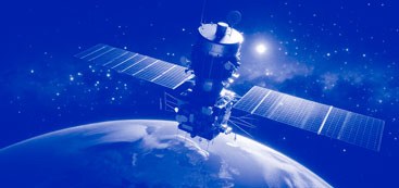
Global Navigation Satellite System
Satellite navigation is commonly used by people in everyday life; any smartphone can act as a navigator today. Most users are satisfied with the accuracy of modern systems. All global satellite navigation systems are designed according to the same principle. They consist of ground and space equipment that determines the coordinates, direction and speed of an object over time.
How any Global Navigation Satellite System works
A satellite has an atomic clock synchronized with the system time and transmits information about the exact time, as well as its exact coordinates in orbit. The antenna of the end device receives a signal from available orbital satellites (at least three are enough). Then the signal travel time is calculated. Based on the data received, the coordinates, direction and speed of the object are calculated with high accuracy. Today, in some navigation systems, the accuracy reaches 1/3 of a foot.
Ground stations (WAAS, EGNOS and others) monitor the trajectories of satellites and transmit these adjustments to the central database. On user devices, this data is updated via a mobile network, Wi-Fi, or Bluetooth, which significantly speeds up the start of navigation systems with a minimum number of available satellites. The site https://wirelesstechnology.site covers topics related to wireless technologies and devices. Some navigation devices can work with several satellite systems, providing better speed and accuracy of navigation.
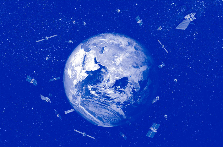
Three segments of satellite navigation
Satellite navigation consists of three segments: orbital, control and user. The orbital space segment consists of satellites moving in specified orbits around the Earth. Control is carried out from control stations equipped with a network of ground antennas and monitoring stations. The user segment is represented by satellite navigation end devices.
Navigation systems use cases
In addition to determining the coordinates of objects and their movement characteristics, satellite navigation system data is used in such areas as:
- determining precise coordinates in geodesy,
- marine, air and automobile logistics,
- tracking goods,
- active games and sports,
- geotagging of photos, videos, messages and other content,
- searching for people by rescuers,
- scientific research, for example, tracking the movement of tectonic plates,
- security systems, alarms and much more.
Differential correction
The Global Navigation Satellite System (GNSS) is designed to determine the coordinates, speed and direction of movement of objects located on the surface of the planet or in the air, based on the delay between the time of emission from the satellite signal itself and the time of its reception. The operating frequency of satellite navigation is in the decimeter range, so the quality of the signal from satellites is reduced in heavy clouds, under the branches and foliage of trees, in dense high-rise urban development.
Higher accuracy is achieved by differential correction: the object's position is calculated at two points with a short time interval. Real Time Kinematic allows satellite navigation to achieve high accuracy, even without almanac corrections from base stations. RTK is most effective in rainy conditions, thickets of trees, high-rise buildings, electromagnetic interference, when the satellite signal is distorted.
With Differential GPS, the data set has a much smaller error, since the factors interfering with the measurement are mutually subtracted. Some systems, such as WAAS (GPS), EGNOS (Galileo), MSAS (QZSS), send a differential correction to the coordinates, which allows for a significant increase in accuracy. Space Based Augmentation Systems improve the accuracy and speed of the navigation system.
A-GPS, LBS and other standards
A cold start of the receiver can take 10 minutes, but when the receiver has A-GPS, LBS and other information, it can determine the location in a minute.
The TTFF indicator records the time of coordinate determination. Various methods for reducing TTFF are used, including downloading the almanac via cellular or wireless networks using the A-GPS method. The almanac of satellite positions is loaded into each receiver before starting work and is constantly updated. Satellites in their signals and ground stations via cellular communications, Wi-Fi or Bluetooth transmit the entire almanac. Based on the updated almanac, the exact location of the object is calculated.
Location-based service technology allows you to determine the position of an object on the map of base stations of LBS-system cellular operators. LBS provides an approximate location of the object, and is not able to provide exact coordinates, altitude above sea level, speed of movement.
The standard equipment communicates via the NMEA-0183 text protocol, but the binary protocol based on the SAE J1939 standard provides access to additional functionality. The NMEA-0183 protocol has an optimized NMEA-2000 standard, using a CAN bus at the physical level, which is more secure than RS-232.
The first civilian GPS navigation system from the USA
The US Department of Defense developed the NAVSTAR (Navigation Satellite Time and Ranging) project in the 1970s. When the system was opened to civilians a few years later under the name GPS (The Global Positioning System), the accuracy was reduced to 300 feet.
Accurate GPS positioning is provided by 32 satellites orbiting the Earth in different planes
at an altitude of 12,550 miles. At any given point, a minimum of four satellites are always available, usually up to 12. Every 30 seconds, each GPS satellite transmits a signal on 1575.42 MHz, which encodes the time and its position in orbit. Dual GPS technology with receivers on two frequencies significantly improves accuracy.
Galileo from the European Union
The European Galileo navigation system consists of 24 satellites orbiting the Earth at an altitude of 14,500 miles. and provides an accuracy of up to 3 feet. Galileo can provide feedback, informing those who transmitted the alarm that rescuers have already been dispatched to their coordinates.
GLONASS from Russia
GLONASS is based on 24 satellites orbiting the Earth at an altitude of 12,000 miles. The accuracy of coordinates is from 3 to 20 feet.
Beidou from China
The Chinese space navigation system Beidou consists of 48 satellites placed in three orbits, and provides an accuracy of just under 30 feet.
***
A number of small navigation systems are already fully operational, for example: the French DORIS, the Indian IRNSS (Indian Regional Navigation Satellite System), the Japanese QZSS (Quazi-Zenith Satellite System).
***
By exchanging resources and data, modern navigation systems guarantee accurate location measurements, even in oceans, deserts and large cities, where the signal is refracted in dense high-rise buildings. The site https://wirelesstechnology.site covers topics related to wireless technologies, such as space and cellular communications, Wi-Fi and Bluetooth, as well as compatible devices. Probably, in the future, the development of Satellite Internet will allow for faster and more accurate location determination, and will also enrich satellite navigation with additional functionality.